Key Points
ANU-Optus Bushfire Research Centre of Excellence, Carbonix and Cloud Ground Control collaborated successfully on an innovative drone-based fire detection demo.
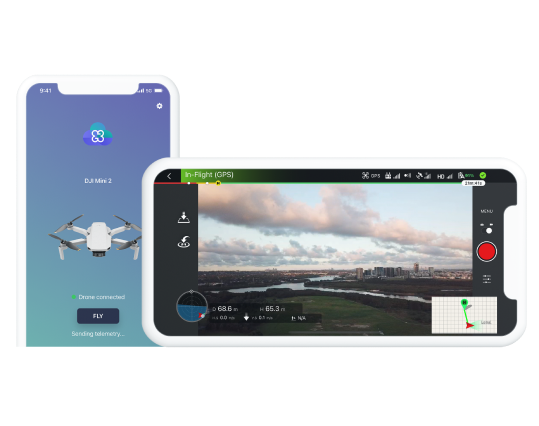
Cloud Ground Control gives drone operators the ability to access real-time data and stream live video from a remote web browser, enabling them to easily command and control their drones from any location.
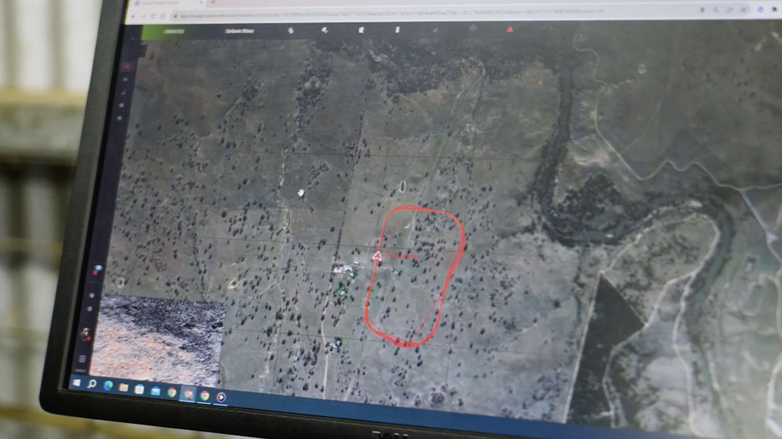
In a live demonstration, featuring Cloud Ground Control, drone operators streamed telemetry, RGB and thermal camera feeds in real time.
Cloud Ground Control empowers fire and rescue teams with complete situational awareness to make informed decisions in real time during emergencies.
Drones synced with Cloud Ground Control can provide a detailed assessment of high-risk areas and alert first responders if fires are detected.
Teaming up Against a Growing Threat
Responding to the increasing risk of bushfires and extreme weather events, a pioneering collaboration has emerged in Australia. Optus, the Australian National University (ANU), Carbonix and Cloud Ground Control (CGC) have teamed up to establish a cutting-edge drone demonstration in the hopes of revolutionising the way bushfires are monitored and managed. Among its broader objectives, the Bushfire Research Centre of Excellence (BRCoE) supported by ANU-Optus will undertake advanced research and develop novel hi-tech solutions to predict, detect and extinguish blazes before they become deadly.
According to Professor Rob Mahony, a renowned expert at the BRCoE, most bushfires in Australia are started by lightning strikes, and if this program is successful, it will assist firefighting authorities in preventing them from occurring.
“Lightning accounts for a large proportion of the total area burned (80-90% in NSW & VIC). And if we can detect those ignitions early enough that we can do water bombing on them, we can stop these catastrophic fires from forming in the really bad seasons,” he says.
The program recently achieved a major milestone by conducting a successful live demonstration of using remote drone technology to stream live footage of an active fire and collect informative data. This accomplishment not only showcased the progress made by the teams involved, but also highlighted the great potential of drones to improve bushfire response strategies, including informed resource allocation, data sharing and technological integration.
“The biggest challenge in bushfire response at the moment is around getting the resources that people want to put in, targeted to things that matter most,” Mahony claims.
Making Real-Time Aerial Fire Detection Possible
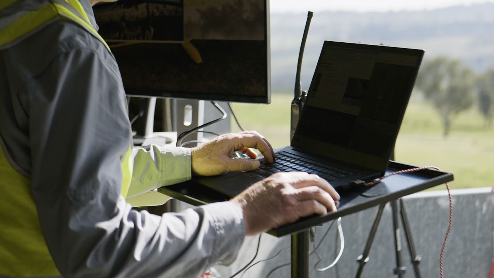
In this collaboration, Carbonix and Cloud Ground Control were brought onboard as the drone and drone management software providers. A specially programmed Carbonix drone successfully completed several surveillance missions, each lasting around 30 minutes. It was equipped with an advanced thermal camera enabling it to navigate a programmed path, collect data and identify fires.
The live video feed, accessible via Cloud Ground Control, provided real-time information on ground conditions. The drone’s impressive precision and agility were on full display as it effortlessly manoeuvred through its flight path, with the ability to approach the event area if necessary.
Cloud Ground Control allows operators to manage missions from a remote web browser.
Head of Product at Cloud Ground Control, Michal Weiss, anticipates this technology will revolutionise emergency and disaster management.
“We’re here today with our technology partners to illustrate a combination of technologies that can empower fire and rescue teams and improve their practices, efficiency and safety” Weiss adds.
She notes that having a swarm of drones equipped with extended hardware not only provides multiple perspectives from the air (or on the ground using rovers), but also a myriad of real-time insights, such as atmospheric and fuel conditions, geographical mapping, thermal imaging among others. And when paired with the right software platform, like Cloud Ground Control, these sources of intelligence can be seamlessly shared among various teams to optimise their responses.
“Cloud Ground Control can help fire and emergency services have that situational awareness that is required to assess and react to an emergency situation,” she says.
How Cloud Ground Control Empowers Drone Operations
Cloud Ground Control is playing a key role by enhancing drone fleet management with centralised control, real-time monitoring and data analytics.
“When operating autonomous vehicles, it’s very important to have that remote visibility and control, and have it accessible easily through the browser. That’s what Cloud Ground Control is doing for fire and rescue teams across Australia,” Weiss says.
Real-time data and video can be used to improve mission coordination.
Weiss also noted that identifying a fire is only the beginning of any bushfire management plan. Following detection, firefighting teams need to assess the fire, evaluate its exact location and size, and determine safe entry and exit points depending on local terrain and weather conditions.
The use of drones and Cloud Ground Control has made handling complex operations, like this one, much safer and easier. Drones offer precise and thorough information about the fire, enabling firefighting teams to make well-informed decisions with speed and accuracy. Additionally, Cloud Ground Control acts as a coordination tool, supplying real-time updates on the fire’s status and the progress of the firefighting teams through the live video feed.
Leveraging Technology to Detect and Relay Information Instantly
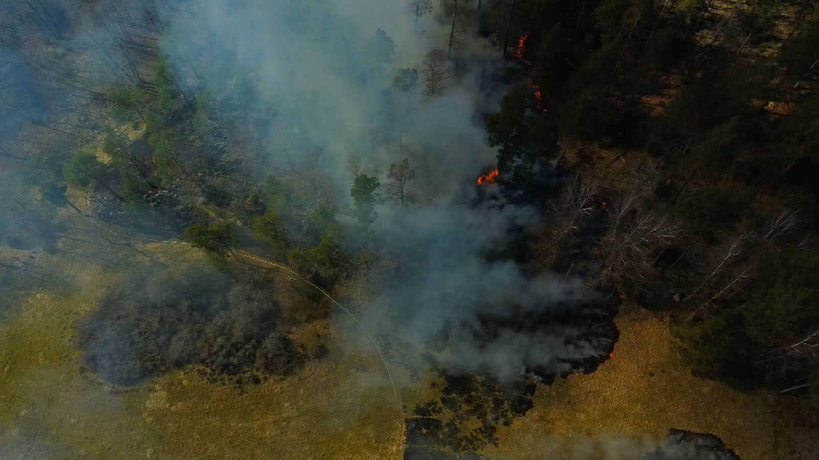
During bushfires, drones can offer a number of additional insights besides visual imagery and live video. While the initial detection of the simulated fire during the live demonstration relied on manual surveillance, the goal is for drones to be equipped with thermal imaging cameras and Cloud Ground Control’s AI algorithms. This will allow them to autonomously detect hotspots and sources of heat in patrolled areas. If any risks are found, the software would notify detection teams to take action. Below is an example of thermal imagery, which shows a temperature distribution of an area in terms of a coloured pattern known as thermogram.
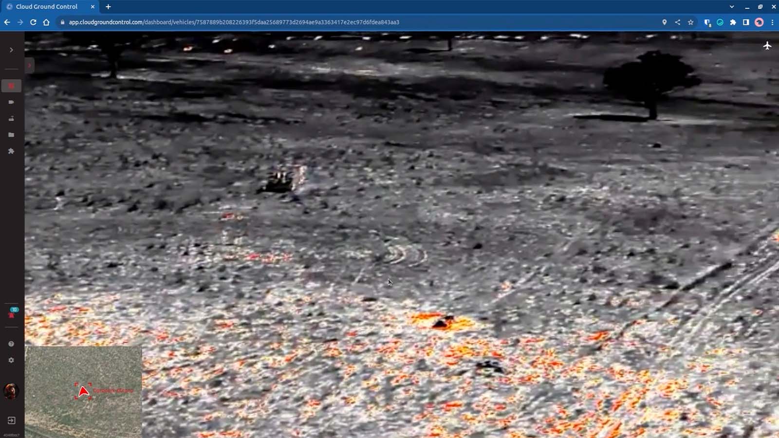
Heat sources and hotspots can be identified with thermal imaging.
Further, drones equipped with Cloud Ground Control’s advanced object identification software can be used to autonomously detect and identify objects such as humans, animals or vehicles. With geo-referenced data, this technology aids rescuers in better planning search and rescue operations, assessing hazards and finding survivors. Additionally, by incorporating the right sensors, the drones could also be used to track changes in fuel condition, wind speed and direction, helping to predict where an active fire might spread. Data like this would be invaluable for response teams, enabling them to make proactive decisions to protect properties, ecosystems and communities.
Revolutionising the Future of Bushfire Management
With bushfires growing more severe and frequent around the world, combating this threat requires a multifaceted approach. ANU is leading the way in fostering partnerships with technology innovators, industry partners and fire and rescue authorities.
Professor Marta Yebra, the visionary leader of the Bushfire Research Centre of Excellence, sees a future in bushfire management that is pioneering and innovative. She foresees that one day autonomous systems assume the frontline in firefighting, consequently reducing the need for human intervention and mitigating risks.
These systems would not only detect fires and track their progression, but also take coordinated action. Alongside satellite fuel flammability mapping, lighting detectors and other innovative technologies, they can even predict where fires might begin, allowing policymakers to target high-risk areas in advance and deploy prevention resources strategically.
“In this world, where fire management is getting more and more challenging with climate change bringing fires more often and with more severity, we need to detect fires early, because the earlier we detect the fires, the higher the chances of first attack success,” she says.
Despite the focus on new technology, she emphasises the importance of human decision-making and control.
“I don’t think we can have a world without humans, so we are developing a lot of autonomous systems for assisting boots on the ground, but we will always need those boots on the ground.”
Drones Give Communities a Fire Fighting Chance
Australia’s ‘Black Summer’ bushfires between 2019 and 2020 serve as a haunting reminder of the unimaginable devastation bushfires can cause. In the face of these intensifying threats, it has become clear that traditional firefighting methods are no longer sufficient in combating them.
What is needed now is a paradigm shift towards adopting autonomous firefighting and detailed sensing technologies. The potential of using drone swarms with a centralised management system like Cloud Ground Control to gather quick intelligence in the fight against bushfires and save lives is clear. Already, the BRCoE, Carbonix, and Cloud Ground Control have shown significant progress in this field.
The integration of drones in conjunction with cutting-edge technologies like AI-based fire detection, satellite fuel flammability mapping and lightning detectors will equip firefighters with the tools they need to combat increasingly complex bushfires. The ultimate goal is to be able to detect and extinguish these fires before they can spread and do harm.
Cloud Ground Control
Developed by Advanced Navigation, Cloud Ground Control (CGC) is a revolutionary cloud-based command and control solution for uncrewed vehicles.
The platform allows pilots and mission planners to remotely command and control a swarm of uncrewed vehicles across air, land and sea via a web browser. By enabling real-time video feed and telemetry, and easy access and management of data, CGC provides fully remote visibility to optimise situational awareness.